About All Tours And Pompeii ToursPompeii from Naples ToursFrom Sorrento ToursFrom Naples ToursPompeii From Rome Tours Directions Hours & Fees Guides
Find Tours 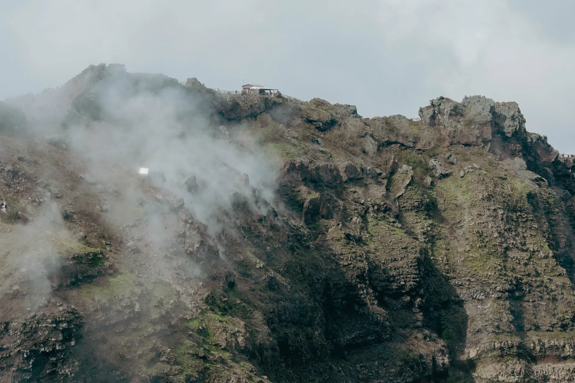
Mount Vesuvius is an active stratovolcano rising 1,281 meters above the Bay of Naples in southern Italy. It's the only active volcano on the European mainland and the source of the 79 AD eruption that buried Pompeii and Herculaneum.
Mount Vesuvius is an active stratovolcano located nine kilometers east of Naples in the Campania region of Italy. It forms the centerpiece of the 8,482-hectare Vesuvius National Park. The mountain reaches an elevation of 1,281 meters. Roughly 700,000 people live in the designated red zone surrounding its base.
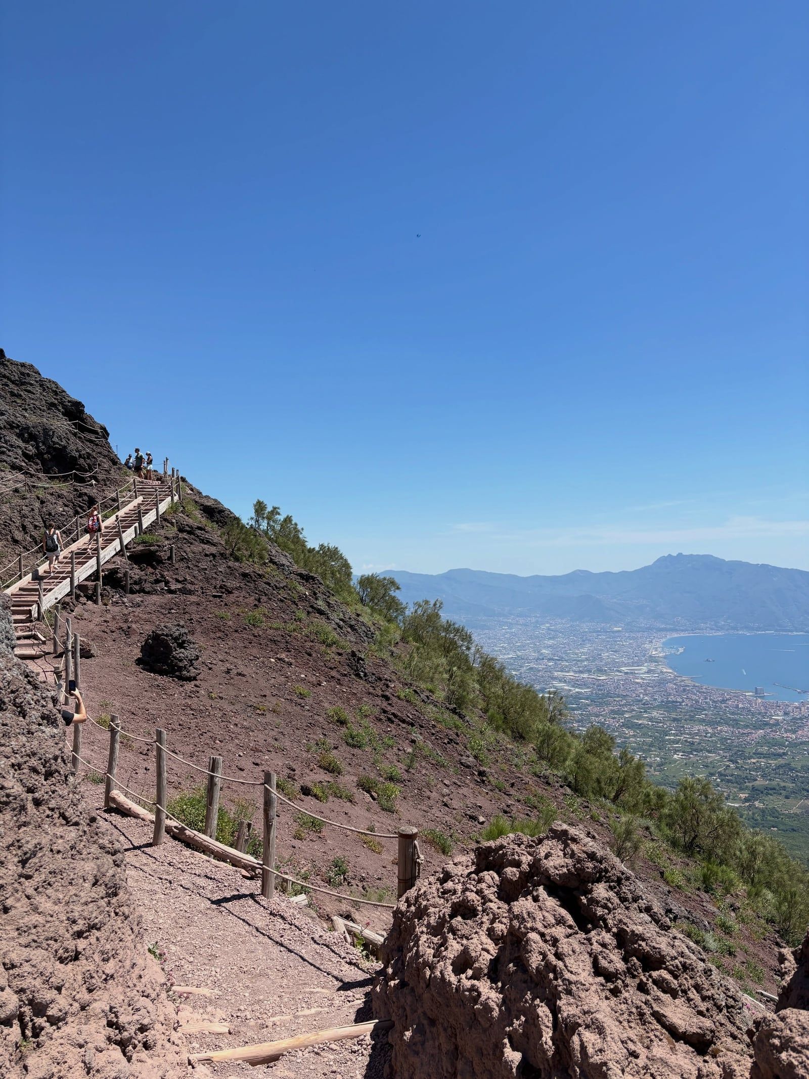
Visitors access the summit via Trail No. 5, a 1.5-kilometer gravel path leading up to the Gran Cono crater. The crater measures 450 meters across and drops 300 meters down into the mountain. Small fumaroles vent sulfurous steam from cracks in the rock near the rim. That is the only visible surface activity on a mountain that last erupted in March 1944. The trail offers clear views of the Bay of Naples, the Sorrento Peninsula, and the islands of Capri and Ischia.
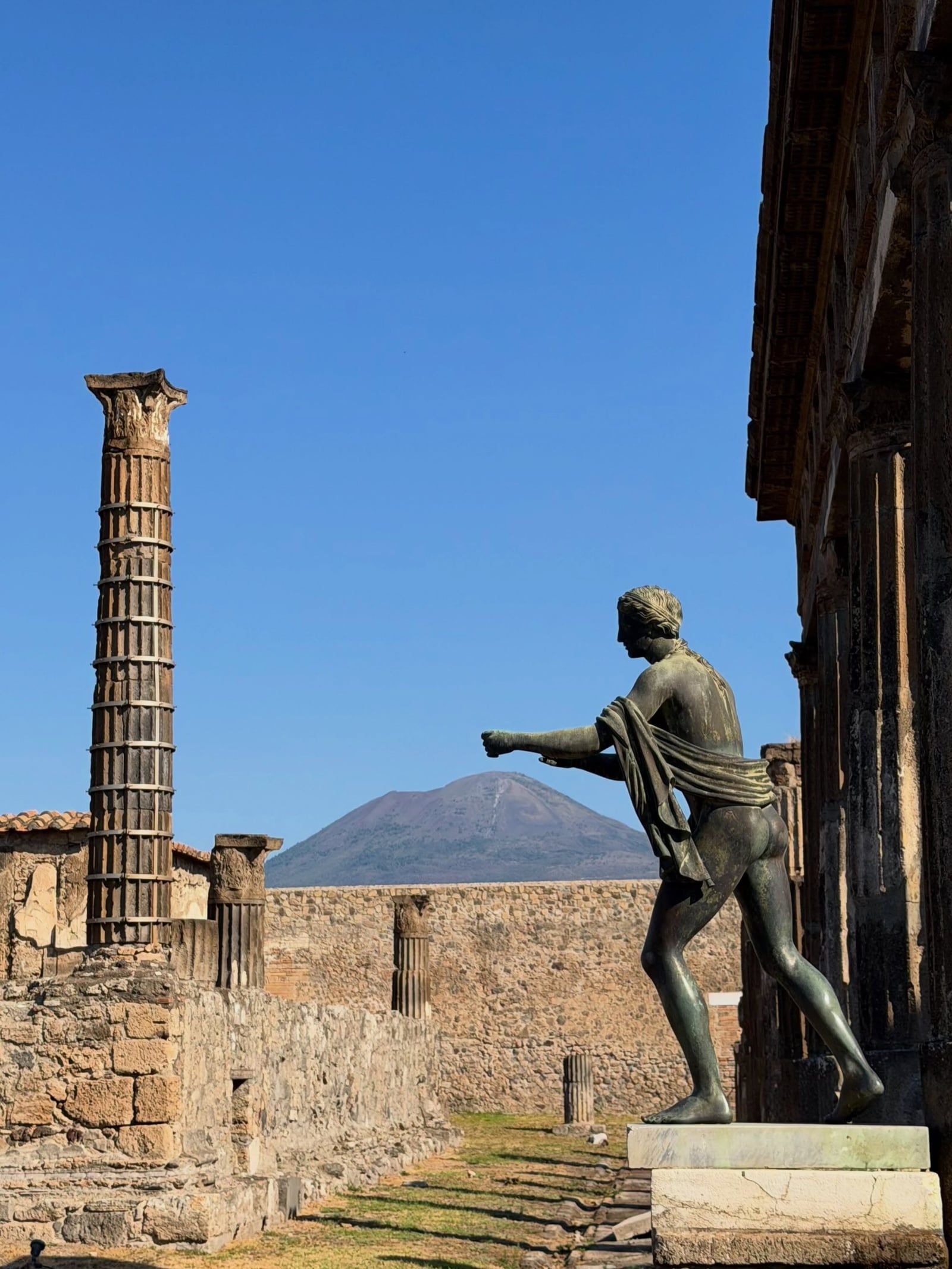
The volcano is globally recognized for its 79 AD eruption. That event buried the Roman settlements of Pompeii, Herculaneum, Oplontis, and Stabiae under meters of ash and pumice. The ash preserved a precise physical record of first-century Roman daily life. Today, the surrounding park operates as a UNESCO Man and the Biosphere Reserve, protecting the volcanic terrain and the rare flora growing on its slopes.
Mount Vesuvius grew inside the caldera of an older volcano called Mount Somma. Mount Somma last erupted about 17,000 years ago, collapsing inward to form a massive depression. The modern cone of Vesuvius eventually pushed up through this collapsed center, creating the Somma-Vesuvius complex. Today, the remnant ridge of Mount Somma still wraps around the northern and eastern sides of Vesuvius. The Valle del Gigante, or Giant's Valley, separates the two peaks.
In the autumn of 79 AD, Vesuvius produced a Plinian eruption that reached a Volcanic Explosivity Index of 5. The mountain ejected a column of ash and pumice 33 kilometers into the stratosphere. As the column collapsed, pyroclastic flows swept down the slopes and buried Pompeii, Herculaneum, and several smaller coastal towns. The eruption killed over 1,000 people, with total estimates ranging between 1,500 and 3,500 casualties. Pliny the Younger watched the event from across the Bay of Naples and documented the destruction in two letters to the historian Tacitus.
The volcano has erupted roughly three dozen times since the destruction of Pompeii. A massive eruption in 1631 killed thousands and initiated a period of frequent activity. Lava flows repeatedly altered the mountain's shape between 1631 and the mid-20th century. In 1841, Ferdinand II of Bourbon established the Vesuvius Observatory on the lower slopes. It was the world's first institute built specifically to monitor volcanic activity.
Vesuvius last erupted in March 1944 during World War II. The event produced lava flows and ashfall that damaged nearby towns and destroyed Allied aircraft stationed at a local base. Since then, the volcano has remained dormant. The Italian government established the Vesuvius National Park on June 5, 1995, to manage tourism and protect the geological site. Scientists at the National Institute of Geophysics and Volcanology continuously monitor the mountain's seismic activity.
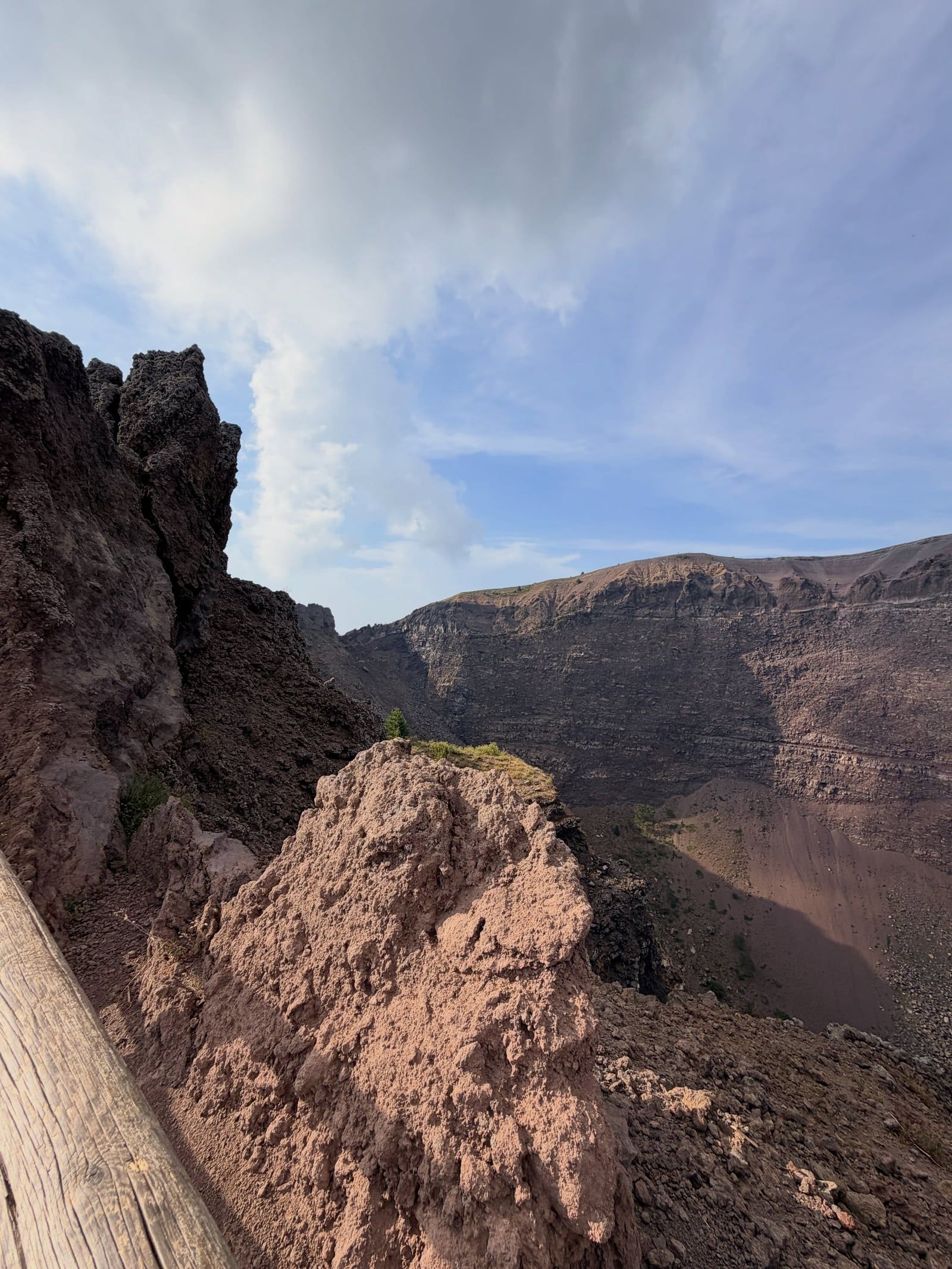
Mount Vesuvius has a frusto-conical shape, meaning it forms a cone with a flattened, truncated top. The main peak reaches an elevation of 1,281 meters above sea level. It sits inside the broken caldera ring of Mount Somma. The highest point of this older outer ridge is Punta Nasone, which stands at 1,132 meters. The Valle del Gigante sits between these two structures, holding layered lava flows and ash deposits from eruptions spanning three centuries.
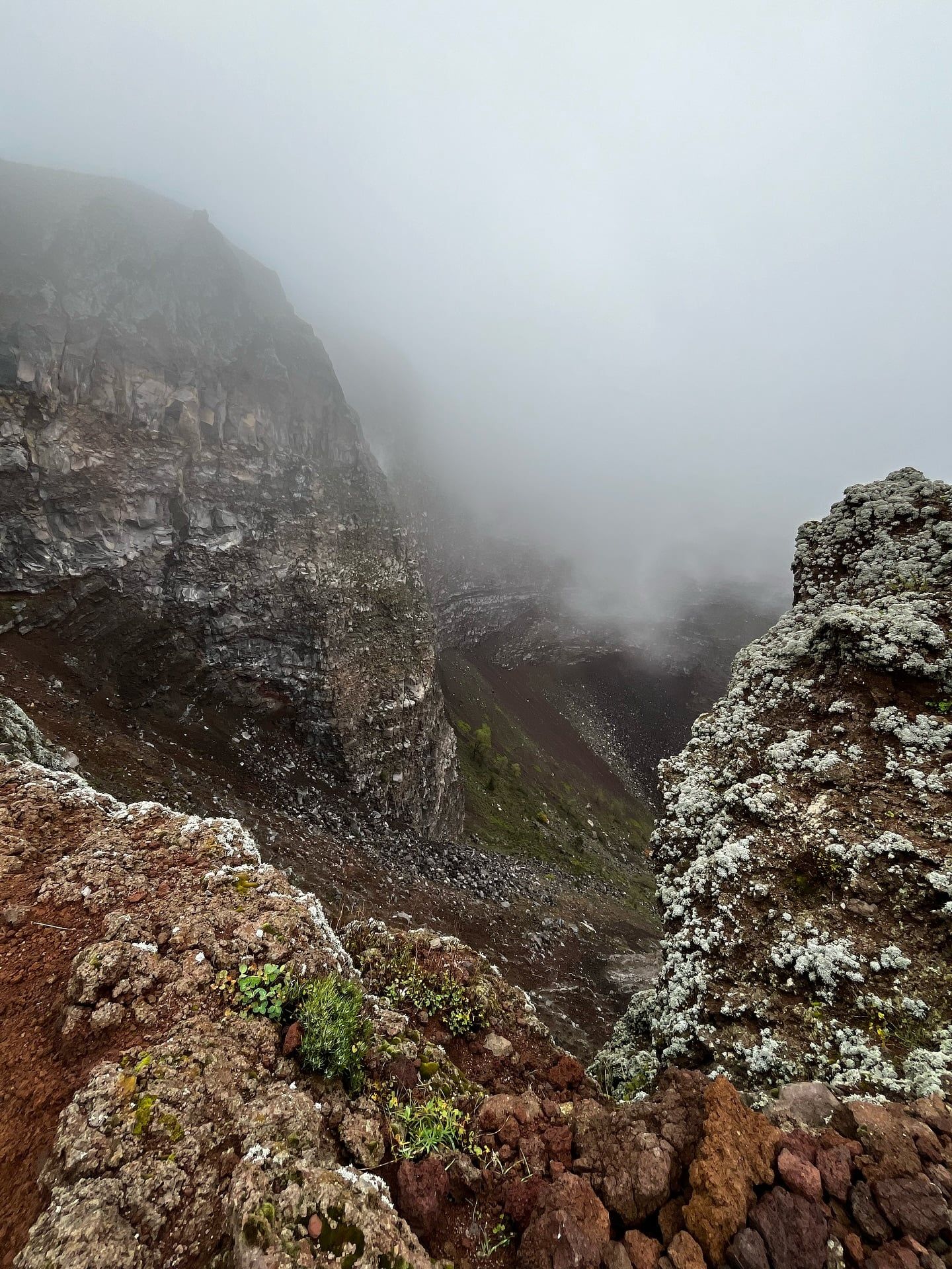
The summit contains the Gran Cono, a crater measuring 450 meters in diameter and dropping roughly 300 meters down. The crater walls are steep—composed of loose, dark volcanic ash and gravel—and small fumaroles line sections of the inner rim. These vents release sulfurous gases and steam, indicating the magma chamber remains active deep underground.
The surrounding 8,482-hectare park features stark transitions in terrain. The upper slopes consist of exposed, grey volcanic rock with little shade. Lower elevations support pine forests, Mediterranean scrubland, and vineyards growing in the mineral-dense volcanic soil. In the spring months of April through June, yellow broom and purple valerian bloom across the ash fields. The trail surface itself is unpaved. It consists entirely of loose pumice, pebbles, and ash that shift underfoot.
The 79 AD eruption made Vesuvius a permanent fixture in the study of antiquity. The ash that buried Pompeii and Herculaneum acted as a preservative, sealing multi-story buildings, frescoes, and organic remains for nearly two millennia. This accidental time capsule gave archaeologists an exact physical record of Roman society.
Today, Vesuvius dictates the urban planning of the entire Campania region. It sits within a designated red zone encompassing 25 municipalities. Roughly 700,000 residents live in the immediate shadow of the volcano. The Italian Civil Protection Department maintains a mandatory evacuation plan designed to clear this entire population within 72 hours if seismic warning signs appear.
The mountain also shapes local agriculture. The volcanic soil is highly porous and loaded with potassium. These conditions support the cultivation of specific regional crops, including Piennolo tomatoes and the grapes used to produce Lacryma Christi wine. The volcano is a constant physical presence over the Bay of Naples, defining the city's skyline and serving as a daily reminder of the active geology beneath southern Italy.
Vesuvius is the only volcano on the European mainland to have erupted in the last hundred years.
Pliny the Younger's letters about the 79 AD disaster gave scientists the term "Plinian eruption" to describe large explosive events.
The Vesuvius Observatory, founded in 1841, was the first scientific institution built specifically to monitor a volcano.
The modern cone of Vesuvius grew out of the collapsed caldera of a much older volcano named Mount Somma.
The March 1944 eruption destroyed over 80 B-25 Mitchell bombers belonging to the United States Army Air Forces stationed nearby.
The national park restricts trail access to exactly 360 hikers per hour to prevent overcrowding on the narrow ash paths.
Despite the harsh volcanic soil, the slopes turn bright yellow and purple in spring when broom and valerian flowers bloom.
A full-fare ticket to hike the crater trail costs €10.00, plus a mandatory online booking fee of €1.68. Reduced tickets are available for visitors under 25, and children under six enter for free.
No. There's no ticket office at the trailhead. All visitors must purchase a timed-entry ticket online in advance.
The walk from the Piazzale Quota 1000 trailhead to the crater rim takes about 1 to 2 hours round trip. The path covers roughly 1.5 kilometers each way on a moderate incline.
The volcano last erupted in March 1944. This event produced lava flows and ashfall, but it was much smaller than the famous 79 AD explosion.
The volcano is currently dormant and safe to visit. Scientists continuously monitor its seismic activity and expect to have at least two weeks of warning before any major eruption.
You'll need sturdy, closed-toe hiking shoes or trainers. The trail consists of loose volcanic ash and gravel that easily gets into sandals. Bring a windbreaker, as temperatures drop at the 1,281-meter summit.
Take the Circumvesuviana train from Naples to the Ercolano Scavi station. From there, the Vesuvio Express shuttle bus runs directly up to the mountain's trailhead.
There are no full dining facilities on the mountain. A small shop at the trailhead sells coffee and snacks, but you should bring your own water for the hike.
Yes, the graded gravel path is manageable for children. However, adults must supervise them closely near the steep crater edges and unguarded ash slopes.
Yes. The park authorities close the trail during high winds, heavy rain, or snow. The loose volcanic ash becomes too slippery and hazardous in poor conditions.
Browse verified tours with free cancellation and instant confirmation.
Find Tours